The Project of enhancing
National Forest Resources Inventory System
contributing to Sustainable Forest Management

Remote sensing
Landcover map
Two types of maps were created in response to the Project’s progress.

Maps created from past satellite images to establish field survey points for inventory in the initial stage of the Project (Source: Landsat 7, 2002-2003)

More accurate maps that reflect the latest satellite images and the results of field surveys (Source: Landsat 8, 2014)
Forest type definition
Types of forests identified for the Project
Ground truth
Sites were confirmed because field conditions cannot be fully understood using high-resolution images alone.


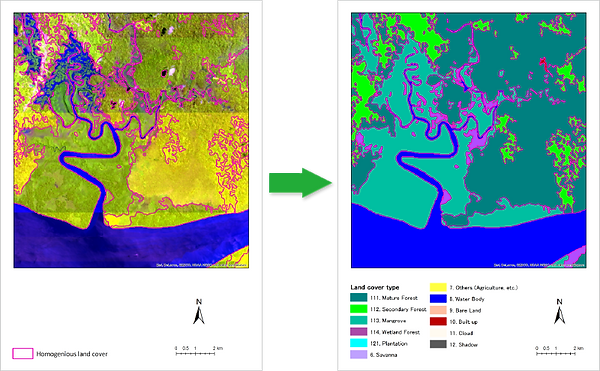
Satellite image analysis method
Process of creating land cover map
Created through object classification using Landsat with high-resolution images (some areas) as references.
Object oriented image classification
Classification by grouping (objectifying) similar pixels from satellite images using special software equipped with this function.
Objects are classified based on samples (training data) from each category that are extracted with reference to the ground truth and high-resolution images.